The Invisible Bordeaux blog was launched seven years ago, on December 1st 2011, and ever since has delivered a steady succession of arti...

All about the Invisible Bordeaux seven-year itch!


The Invisible Bordeaux blog was launched seven years ago, on December 1st 2011, and ever since has delivered a steady succession of articles, interviews and reports about some of the city’s lesser-known sights, stories and people. 

Right now, as a direct result of what the blog has become over the years, no less than three separate Invisible Bordeaux-related projects are taking shape behind the scenes, and I am very much looking forward to unveiling the various spin-offs from early 2019 onwards. I’m not going to reveal too much for now, but rest assured some interesting formats, encounters and stories are being developed and will soon be coming your way! 

Soooo, over the coming weeks, on the various Invisible Bordeaux social media channels, I will be promoting some archive reports that are hidden away in the depths of the blog… while working hard on what comes next! 

Enjoy (re-)discovering these past items via the Invisible Bordeaux social media accounts, and watch this space for the next chapters in the Invisible Bordeaux story!  

> Stay tuned by following Invisible Bordeaux on Twitter, Facebook and Instagram!  

5 commentaires:

After occasionally bumping into tour guide Marie Hallier at various functions in Bordeaux and featuring an article she had written abou...

Seeing the Gironde estuary through the eyes of tour guide Marie Hallier

After occasionally bumping into tour guide Marie Hallier at various functions in Bordeaux and featuring an article she had written about the colour of the Garonne river on the blog, Marie suggested we team up, along with Bordeaux Expats’ Mike Foster, for a day travelling along the right bank of the Gironde estuary. 

Having recently returned from a cycling tour of that area, I was keen to go back and take in some of the sights I may have missed the first time round. Along with Mike, we were also very much looking forward to spending some quality time in the company of a renowned guide whose territory stretches from Bordeaux to the Médoc and the Bassin d’Arcachon, and who has become especially regarded as an authority on the north bank of the Gironde estuary and the wine-growing (and brandy production) area around Cognac. 

And so it was that we joined forces at our designated meeting spot near an exit of the A10 motorway, and hopped into Marie’s people-carrier heading for our first stop, Saint-Georges-de-Didonne, just to the south of Royan. Together we admired Phare de Villières lighthouse and the stone memorial to the Operation Frankton commando raid on Bordeaux (a recurring theme on the blog of late) before driving south to the other side of the “Conche de Saint-Georges”, in other words the bay where the town of Saint-Georges has developed, and on to the Pointe de Suzac, the very spot where the Gironde estuary and the Atlantic ocean merge… although that merger is very much tangible: Marie pointed out the line in the waters where the Gironde’s distinctive brown turns to sea blue!

So this is where the estuary ends and the ocean begins.
But the treasures of the strategically-located Pointe de Suzac extended far beyond the spectacular view: we first ventured into the open remains of a Napoleonic-era guard house and gunpowder magazine before exploring a whole battery of bunkers which were a component of the extensive Atlantikwall means of monitoring and protecting the coastline during Germany’s occupation of the area during the Second World War. The then heavily-protected zone (surrounded by minefields), which became the so-called “poche de Royan” of German resistance post-Liberation, was bombed by off-shore Allied forces in 1945. The Germans stationed here finally surrendered on April 15th 1945.

The Napoleonic guard house and gunpowder magazine. 
From then on the area was first abandoned before being turned into a children’s playground and then a motocross track! In more recent years the local council has gradually turned it into a peaceful rambler's paradise, with its hiking trails and viewpoints. Of course, the Atlantikwall bunkers won’t be going anywhere in a hurry, and we peeked inside a number of them, trying to imagine what life must have been like for the German troops here back in the day. 


Marie’s next plan was to make our way to the scenic village of Talmont-sur-Gironde, via the small resort and marina of Meschers and past the wild bay comprising what Googlemaps labels successively as Banc de Dau et Banc du Bœuf. The ecosystem there is evolving as the area becomes more and more heavily silted over time.

As Talmont had been a stop on my recent cycling tour, again I was looking forward to hearing Marie’s take on some of the more unusual aspects of the village. She didn’t disappoint, sharing tales of the routines of Talmont’s sole remaining fisherman, revealing abandoned plans made first by the Americans to transform the village into a massive military port, and then by the French to convert it into an oil terminal, showing what remains of a lane which separated the Catholic and Protestant graveyards, and explaining the story and symbolism behind the “ex-voto” model boat which hangs from the ceiling in Sainte-Radegonde church. She even gave background information as to why Sainte Radegonde was such an emblematic figure in Charente-Maritime. Other subjects which were raised were the effects of erosion, the canal lock system, recycled cannonballs, disappearing sundials, how a carrelet fishing hut raised money for charity, and the special relationship between Talmont and handcrafted weather vanes. Needless to say, Mike and I were impressed! 

Clockwise from top left: the only fisherman in the village's boat, warnings of erosion, the ex-voto suspended boat, and Mike inspecting the canal lock system.
Back in the people-carrier we were now headed towards Mortagne-sur-Gironde but stopped en route to take in one of Marie’s favourite views over the estuary, at a spot where we were also able to observe the effects of “poldérisation” (the reclaiming of land): after low-lying agricultural land became flooded in 1999, the decision was made to let nature take its course once again, and the resulting marshland is now home to a wealth of fauna and flora. 


Arriving in Mortagne-sur-Gironde, we headed to the heights of the port town, to take in another cracking view over the estuary and to inspect an unusual hand-shaped monument celebrating the achievements of the Welsh prince and soldier Owain Lawgoch (Owain of the Red Hand), who fought for the French against the English in the Hundred Years’ War, notably during the siege of Mortagne castle. The story arguably merits its own Invisible Bordeaux investigation sometime in the future!


But the best was yet to come, as we made our way down to estuary level to visit the rather unique Saint-Martial hermitage. There we and other visitors were greeted by two enthusiastic volunteer tour guides, Patricia and François, who proceeded to theatrically walk us through the site, which began as a hermitage in medieval times, became a monastery in the 18th century and then a shepherd’s haven, before opening to visitors passing through from the early 1900s onwards. And, unusually, the various rooms are either natural caves or were hand-carved out of the cliff-face.


The visit started out with the steep 25-metre climb to the circular bell tower perched at the top of the cliff, reached via a tall, narrow stone staircase. Then it was on to the prayer room and the “salle d’eau” (fed in the past by freshwater springs which have since dried up, although another one has recently been discovered). Throughout, Patricia and François exuded plenty of excess energy which was part contagious and part mystifying, although they took things to a whole new level when we reached the small but very impressive chapel. 


As we entered, we were promised a “son et lumière” show, the first chapter of which was Jeff Buckley’s version of Hallelujah being played through a Bluetooth speaker hidden behind the solid stone altar. Patricia tried to get everyone to join in on the choruses, making for a bit of an uncomfortable, half-hearted sing-song with complete strangers. Then, after François had noisily slammed the door shut in full-on escape game mode, we were treated to various combinations of pulley-operated open and closed slats, demonstrating how the original creators of the chapel played with direct and indirect sunlight. There was much scripted talk of acoustics, statues and stone (often the two clearly lovestruck guides speaking in perfect unison), and the whole experience was as interesting as it was at times surreal. Mike and I were slightly shell-shocked as we got back into Marie’s people-carrier, but we also realized that we had been given an insider’s glimpse into one of the most surprising sights in the whole region.

We felt strangely lucky, privileged even, and were now homeward bound, driving back to where we had met up a few hours earlier. Even the commuting had proved to be an engaging experience: between the various stops there had been much fascinating conversation about Marie’s life as a tour guide, working with travel agencies, tourism offices, cruise ships and private groups, the ever-escalating importance of social media, the relatively unregulated tour guide marketplace in Bordeaux and the unlevel playing field of having to compete with unlicenced cash-in-hand counterparts, and many more subjects besides! 

After we had said our goodbyes, Mike and I reflected on the undeniable added value of having a bona fide guide to lead the way. Marie’s mission was truly accomplished and she can now proudly add the unofficial “Approved by Invisible Bordeaux and Bordeaux Expats” label to her enviable list of qualifications!

> Marie Hallier’s various tours are detailed on her website, www.bordeauxcognactourguide.com, and she can also be found on Facebook and Twitter
> Marie Hallier has also co-authored an excellent guide to the estuary, “Je découvre l’estuaire de la Gironde”, published by La Geste Girondine (pictured here). 
> Photography was not allowed inside the chapel of Saint-Martial hermitage, but a few pictures can be seen online here.  
> Ce dossier est également disponible en français !

2 commentaires:

As you may have gathered, Bordeaux is making regular appearances in easyJet Traveller, the in-flight magazine available on board all easy...

Bordeaux ghost signs featured in easyJet Traveller in-flight magazine

As you may have gathered, Bordeaux is making regular appearances in easyJet Traveller, the in-flight magazine available on board all easyJet aircraft as they criss-cross Europe in all directions. 

Throughout October 2018, the subject is so-called ghost signs, faded handpainted signs and advertisements that have somehow managed to survive the test of time... and one of the recurring themes on the Invisible Bordeaux blog over the years!

Five of the city's prettiest signs feature in this "listicle", which is a pleasing case of old-school communications and design finding their way into the hands of modern-day travellers!

> You can read the full article by clicking here:
> The full October 2018 issue of easyJet Traveller magazine can be viewed here: https://ink-global.com/partners/easyjet/magazines/easyjet-inflight

0 commentaires:

A Sud Ouest article about a solemn ceremony recently held in Cestas to remember the victims of a massive forest fire which occurred ba...

The great Landes forest fire of 1949


A Sud Ouest article about a solemn ceremony recently held in Cestas to remember the victims of a massive forest fire which occurred back in 1949 prompted Invisible Bordeaux to research the background to this tragic event, which claimed 82 lives.

The story begins around lunchtime on Friday 19th August 1949 at the Pioton sawmill in an area known as Le Murat, mid-way between Saucats and Marcheprime, 30 kilometres to the south-east of Bordeaux. A warden there was lying in his bed and fell asleep while smoking a cigarette (although some accounts suggest it was an unattended stove). The hut caught fire and the flames quickly spread to the rest of the sawmill. The column of smoke was soon spotted from the tall lookout towers in nearby Biganos, Béliet and Cabanac.

This dirt track leads towards Le Murat, where the fire started. Today it is part of the GR655 "Grande Randonnée" path.
The first people on the scene were armed with nothing more than tree branches to attempt to put out the fire, and could do nothing to prevent the flames from gaining momentum and covering further ground. The surrounding trees and bushes, which were particularly dry after a third consecutive summertime heatwave, quickly went up in smoke too.

In these post-war years, the forests in the area were poorly-maintained, dense (resin production was lucrative) and not especially accessible, and fire-fighting methods and resources were far from efficient. There were rushed attempts to set up fireproofing means to stop the wildfire spreading further, but the flames were having none of it and, fanned by strong north-eastern winds, were progressing rapidly towards Le Barp to the south-west. By now, the frontline of the fire stretched five kilometres across, and additional attempts were made to contain its progress. However, overnight, the winds changed direction, prompting the forest fire to make rapid headway, this time in a westerly direction, covering up to four kilometres per hour and soon threatening the villages of Salles and Mios.  

Fighting the flames armed with buckets of water and branches. Source: INA video.
Homes and barns going up in smoke. Source: Sud Ouest.
Then, by mid-morning on Saturday 20th August, it was thought that the forest fire had finally been brought under control when, suddenly, the winds changed direction once more, continued to gain strength and sent the flames back in a north-easterly direction. The forest fire picked up yet again, this time more powerfully than ever, including in areas where the flames had previously died down. Over the course of an incredible 20-minute spell, the fire engulfed 6,000 hectares of land, instantly and horrifically killing 82 firefighters who had been working to contain the fire on its northern flank. The victims were mainly volunteers from the surrounding villages, some civil servants employed by the Eaux et Forêts State department, and 23 soldiers from a field regiment stationed in Châtellerault, central France. Only seven people survived what instantly became – and still remains – France’s deadliest-ever forest fire.

Engulfed by smoke and flames. Source: INA video.
Throughout that afternoon, the pillar of smoke could be seen from points up to 100 kilometres away and the whole of Bordeaux and its surrounding area were plunged into other-worldly darkness by 5pm (streetlights had to be switched on unusually early that day). Around 10pm, the winds finally dropped and two danger zones remained near Léognan and the Pierroton district of Cestas, but on the whole the situation was now under control, and the final remaining flames were extinguished on Thursday 25th August, following on from a day of national mourning held on the 24th. In all, 50,000 hectares’ worth of pine forest had burnt down along with 710 hectares of bushland. According to contemporary reports (which put the overall death tally at 106), “hundreds” of farms had been destroyed and thousands of villagers had been driven from their homes (more recent accounts state that 60 homes burnt down).

The French head of government, Henri Queuille, was present at the mass funeral held a few days after the fire had subsided. Proceedings were led by the Archbishop of Paris, Monseigneur Feltin, and alongside the villagers were firemen from Kent in south-eastern England, who had been drafted in to support rescue operations in the area.

Dignitaries, mourners and Kent firemen at the funeral ceremony. Source: INA video.
Understandably, for those who had been directly and indirectly affected by the wildfires, life would never be the same again. In comments posted beneath an authoritative online account of the events (on geographer Christophe Neff's blog "Paysages"), one person recalls being 12 years old and losing his older brother in the tragedy – the latter had been carrying out his military service with the army regiment in Châtellerault when he was assigned to these fateful firefighting duties. Another writes about his father, Jean-Max Salzmann, a military ambulance driver who the Army sent into the area alone with his vehicle to rescue people from the villages which had become encircled by flames. Initially feared dead, Salzmann eventually made it home again, but was one of just three of his 30-strong team to make it out alive. He and his counterparts had however enabled dozens of lives to be saved.

All of the villages which the 1949 forest fire almost wiped out – Cestas, Saucats, Marcheprime and Mios – have, over the years, got back on their feet and been able to flourish. The forests have grown back, no doubt taking into account recommendations about organization and a diversified choice of species made by one Pierre Allemand in related articles published by la Revue Forestière Française in 1950. (See archive copies here and here).

Back in the area, the forest fire is a distant memory. Cornfields on the left and pines on the right: diversity at work and a far cry from the dense, resin-heavy pine forests of yesteryear.
But some observers have been vocal in their assessment that the tragic events have almost been erased from the collective consciousness (which is possibly the reason why it has taken so long for the subject to be featured on Invisible Bordeaux…). In recent years, that particular wrong has been partially righted by the release in 2009 of a benchmark publication, Joan Deville’s “L’incendie meurtrier – dans la forêt des Landes en août 1949”, which delivers a definitive overview of the forest fire and the firefighting methods used, as well as compiling the biographical data of every one of the 82 victims.

 
And, to bring us full circle back to the start of this article, two memorials have been erected alongside the D1010 road mid-way between Cestas and Le Barp, in an area known as Le Puch, not far from Le Murat. The more formal, ceremonial and imposing of the two (pictured above) comprises a haunting bas-relief that depicts the doomed firefighters in amongst the flames. It also lists the names of the locals who perished in what the monument refers to as a “cataclysme atmosphérique”, grouping them according to the communities they came from: Cestas, Léognan, Saucats, Villenave d’Ornon and Talence. The second is a more minimalist, organic pinewood offering, positioned around the spot where most lost their lives. It calls on observers to “respect and protect the forest to honour the memory of the 82 heroes”. Hear hear.

Leaving the area: a lookout tower and a warning sign serve as a reminder of the constant threat that fire represents.
> Find it on the Invisible Bordeaux map: Forest fire memorials, D1010, Cestas.
> Much of the information in this piece was initially detailed and shared by the geographer Christophe Neff on his blog "Paysages", in items available here and here.  
> An incredibly detailed account of the events, including further photos and a map showing the ground covered by the fire, can be found on a personal website here. The site also includes a list of the victims and pictures of further memorials in Canéjan and Cestas, here.
> Ce dossier est également disponible en français.

1 commentaires:

After cycling to Mirambeau , on to Royan and back down to Saint-Seurin-de-Cadourne , it was on to our home straight, although the fi...

Gironde estuary cycle tour 4/4: Saint-Seurin-de-Cadourne > Bordeaux


After cycling to Mirambeau, on to Royan and back down to Saint-Seurin-de-Cadourne, it was on to our home straight, although the first stop on this, our final day, meant a short eastward detour via Saint Germain d'Esteuil to pay a visit to the Domaine de Brion where ruins of Gallo-Roman-era edifices – a theatre, dwellings and a temple – sit silently in amongst the trees and marshland pastures. 

Back in the 1st century AD, this area was still an island, rising above the surrounded waters which have subsided and been irrigated over time. In all likelihood, a whole settlement spread in all directions, and the eminent 19th-century archaeologist Léo Drouyn believed that the area may have been known as Noviomagus, as referred to in Claudius Ptolemy’s Geography, which around 150 AD exhaustively compiled all geographical knowledge of the 2nd-century Roman Empire.

We started out by inspecting the remains of the theatre, which expert estimates suggest could have stretched to a diameter of around 55 metres and held around 2,500 spectators. This is difficult to believe when looking at the isolated sections which have somehow survived all these years, but still we enjoyed picturing the scene, imagining spectators streaming through the archways and up into the stands. To one side stood a more angular formation, which is what remains of a second-generation construction, a medieval-period tower inhabited by a knight who had been banished to the area after seeking to exact money from locals. The tower had been built from stone used for the theatre!

The remains of the theatre.
Advancing a little further into the wild, we viewed what is little more than the foundation structure of two homes, which are resolutely facing the same direction, suggesting some form of urban planning which may arguably have been applied to other Noviomagus buildings. Indeed, also facing the same direction is what remains of a full-on temple, which was reportedly destroyed by fire in the 3rd century and pillaged over subsequent years. Digs carried out in 1989 and 1991 unearthed a significant number of objects, including a number of bronze statuettes that paid homage to Gallo-Roman pagan gods. 

Gallo-Roman housing.
Inspecting the temple.
So why did this hive of activity fade into nothingness? That is a question for historians to deal with but, if our experience is anything to go by, we had to make our time on site as short as was humanly possible because, given the moist environment, we had to contend with the most humongous, aggressive and hungry mosquitoes we think we’ve ever encountered. It became so unbearable that we barely had the time to read the faded information panels, let alone explore the ruins for ourselves. Did flying insects bring down the Roman Empire’s presence in the Médoc then? Whatever, this little-known place deserves greater exposure, something that local authorities are unable to adequately fund at the time of writing.

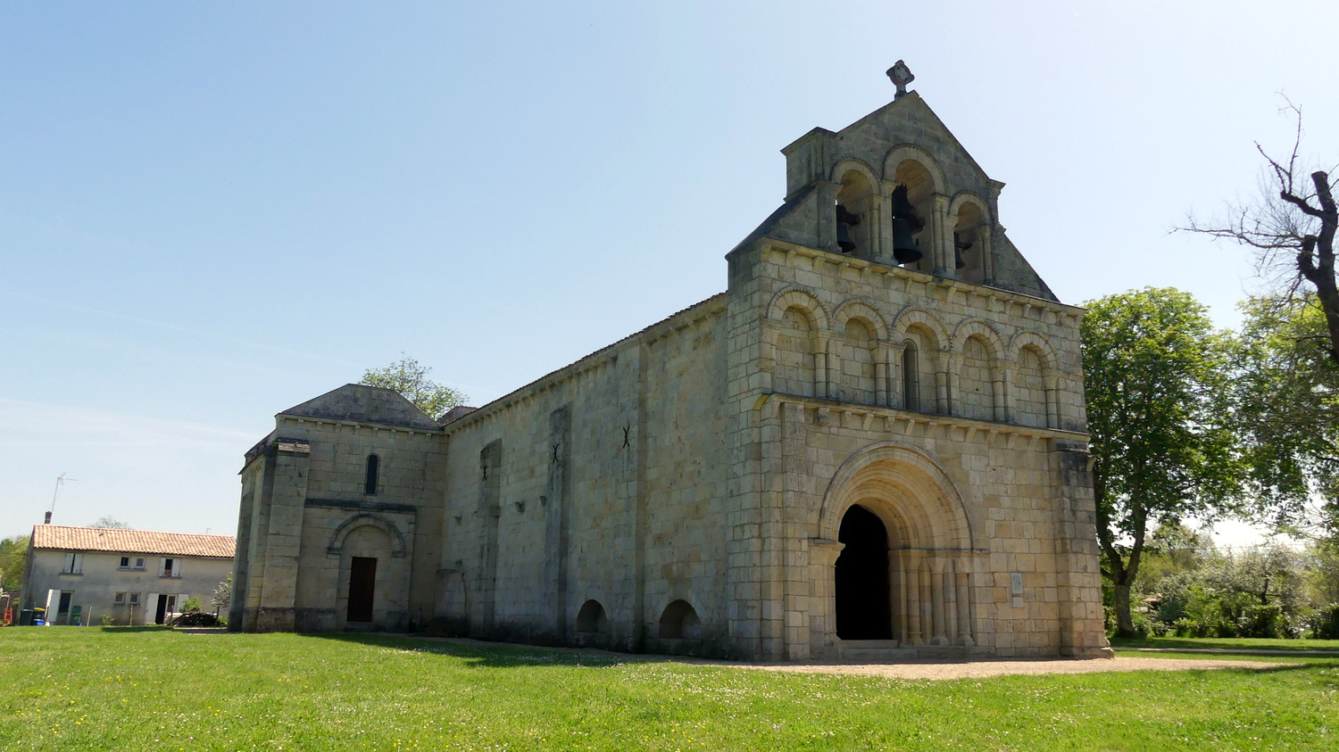
Using the nearby north-south railway line as our guide, we glided fairly effortlessly to our next port of call, the picturesque, semi-perched village of Vertheuil. As peaceful as it was on this springtime Saturday mid-morning, it had clearly geared itself up for its steady trickle of visitors passing through, with a series of ten information panels dotted around the centre, providing stories of bygone times and archive yesteryear photos of the village as it used to be. The small-scale heritage trail, known as Le Musée dans la Rue (museum in the streets), takes in predictable sights such as the war memorial, a small fortified castle, the village hall, the church and its neighbouring abbey. But it also taps into some of the fixtures of village life including the bakery, hairdressers and butchers. It is a fine initiative that makes grassroots history instantly accessible to tourists.

Vertheuil fortifications.
We were then magnetically drawn to the largest community in that central Médoc area, the town of Saint-Laurent-Médoc. There was more life about the place there than anywhere we had encountered since Soulac-sur-Mer. Despite being located some 45 kilometres to the north of Bordeaux, the town is now viewed by many as being inside the city’s commuter belt. But while we were tucking into locally-purchased food sat on a bench on the church square, we spotted a coach service to Bordeaux picking up passengers. Watching people saying their goodbyes, the city still felt a long way away. Just as we were about to leave Saint-Laurent, we stopped outside a café and were about to set up shop on the establishment’s terrace with a view to enjoying a pick-me-up combination of coffee and soft drinks. The café staff turned us away, claiming the late-lunchtime hour meant the place was now out-of-bounds for patrons. Feeling simultaneously thirsty, rejected and ever so slightly dejected, we got back on our bikes.      

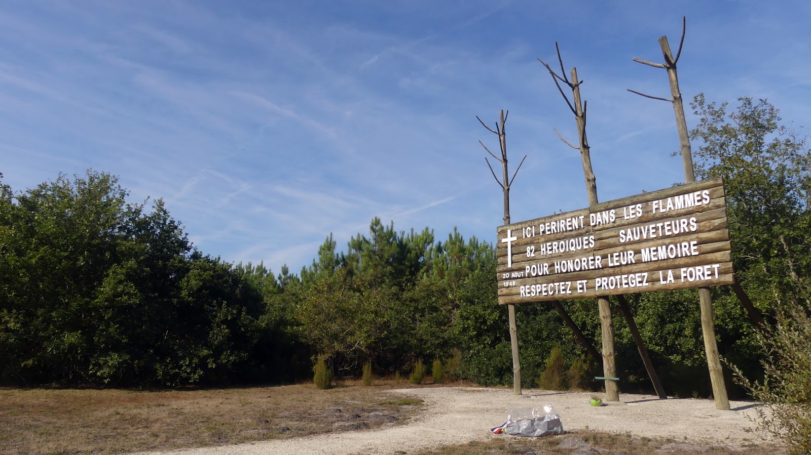
The most logical route hereon would have meant cycling along the hard shoulder of a busy dual carriageway, so we instead looped around to the hamlet of Benon where, to our immense surprise, in the leafy environment niched in behind a fairly anonymous housing estate lay a remarkable 12th-century country church, Eglise Notre-Dame de Benon. We ventured inside and enjoyed the respite delivered by the cool air there, before trying to make sense of one of the wordiest, most incomprehensible memorials I think anyone has ever positioned anywhere in the world. It appeared to commemorate a service held there in remembrance of a Maltese dignitary who died in a plane crash nearby in 1991. The story certainly appeared to merit further research, but we were all so exhausted from just trying to read the panel that we were reluctant to take things to the next level. We went back outside and instead admired the three church bells visible up high, and which alone provide an instant journey through time, cast as they were in 1776, 1873 and 1886. The eldest (and smallest) of the three bells is even listed as an historic monument.

And the Invisible Bordeaux award for the most incomprehensible plaque EVER goes to...
The linear route then took us through another mid-sized town, Castelnau-de-Médoc (where we were at last able to buy in some drinks!), and on to our final brief stop, outside Saint-Raphaël chapel. This tiny place of worship was built here around the late 15th century on the spot that, in 1375, saw the birth of one Pey Berland to a father who was a labourer from nearby Avensan and a mother who was a peasant from Moulis. In spite of these humble roots, Berland was educated by a local notary before being sent to a clerical school in Bordeaux after the death of his father, then to university in Toulouse. Returning to Bordeaux, he became a priest in Bouliac to the south-east of the city around 1412. He went on to become secretary to the Archbishop of Bordeaux, travelling around France, Italy and England in this capacity, before Pope Martin V appointed him Archbishop of Bordeaux on August 13th 1430.


Pey Berland subsequently went on to become one of the most influential of all figures in medieval Bordeaux, and much of what he instigated (at a time when the city was in profound moral and economic turmoil) continues to live on today. The aptly-named Tour Pey-Berland, the cathedral’s bell tower, the construction of which began under his authority in 1440 (it was completed in 1500), is the lasting landmark which is most naturally associated with him, but he is also responsible for the founding of the original University of Bordeaux (in 1441), Saint-André hospital and a number of secondary schools. Pey Berland, we therefore salute you, as does the virgin mother and child statue positioned at the very top of Tour Pey-Berland, which symbolically faces in the direction of Saint-Raphaël.

By now we were barely ten kilometres from our Saint-Aubin-de-Médoc basecamp. Four days of virtually continuous cycling had taken their toll and our average speed over the final stretch was certainly nothing to get overly excited about, but there was a definite sense of job very much done as we turned back into our street. Via Margaux, Lamarque, Blaye, Mirambeau, Talmont-sur-Gironde, Saint-Georges-de-Didonne, Royan, Le Verdon-sur-Mer, Soulac-sur-Mer, Jau-Dignac-et-Loirac, Saint-Seurin-de-Cadourne, Vertheuil, Saint-Laurent-Médoc, Castelnau-de-Médoc and many more places in-between, we had cycled all the way up one bank of the Gironde estuary and back down the other, and life on the saddle of a bicycle doesn’t get much better than that.

Gironde Estuary cycle tour day 4 mapped out.
And, in case you missed them, here is where you can rewind to day 1, day 2 and day 3 of the Gironde estuary cycle tour!

1 commentaires:

Having cycled from Bordeaux to Mirambeau and on to Royan , here we are on day three of a tour of the Gironde estuary, which started of...

Gironde estuary cycle tour 3/4: Royan > Saint-Seurin-de-Cadourne


Having cycled from Bordeaux to Mirambeau and on to Royan, here we are on day three of a tour of the Gironde estuary, which started off with us following signposts to the ferry port in Royan so we could cross back over to the left bank of the estuary. 

En route we engineered a short detour to view our second Operation Frankton memorial. This one was formed by a flower-like arrangement of five canoe-shaped “petals”, four of which are made of see-through blue Perspex. Behind the various shades of blue lay the spot in the distance where the Marines exited the submarine that had brought them from the UK to south-western France on this daring mission.


The ferry we caught, L’Estuaire, was a wider, longer and generally meatier affair than its Lamarque-Blaye counterpart further upstream, built to carry up to 600 passengers and 138 cars (whereas the Sébastien-Vauban caters for a lowly 300 passengers and 40 cars). After a 20-minute voyage we were back on dry land and cycling the short distance towards the very northern tip of la Gironde, la Pointe de Grave, to inspect the three memorials that I had last viewed during my Girondin four corners road trip: one saluting General Pershing’s First World War US troops who had defended France, another generally commemorating all those who gave their lives in the fight for the freedom of France during the Second World War, and the third completing our trilogy of Gironde estuary Operation Frankton memorials. This one comprises four separate leaning stone panels, providing a full historical overview of the raid, an illustration depicting the mission in progress, and a host of military insignia.


We had our own leisurely mission to accomplish, so we picked up the southbound cycle path running alongside a disused railway track parallel to the Atlantic coastline, which took us all the way into the pleasant northern Médocain seaside resort of Soulac-sur-Mer. Our first port of call was one of the world’s many replicas of the Statue of Liberty, symbolically positioned on the seafront looking out towards the United States. An explanatory text at the base of the statue explains that it was commissioned by the town in 1980 and manufactured by the Paris ateliers of Arthus-Bertrand, using the original mould designed by sculptor Auguste Bartholdi. However, an urban legend also suggests that the statue is the very one which was located on Place Picard in Bordeaux from 1888 until its disappearance at the hands of the Germans in 1941. Which version is true? Most probably the former…


We were then naturally drawn towards le Signal, an angular apartment block which has long been an eyesore for some, but was a much-loved home and holiday residence for others and was initially set to be just the first of a number of such buildings in Soulac. Importantly, when it was built, between 1965 and 1970, the ocean was a good 200 metres away. But over the ensuing years, the Atlantic has literally gained ground on this lone building, at a rate of between four and eight metres per year.

Le Signal therefore now perches precariously at the water’s edge, and after the violent winds and harsh tides of early 2014, the Atlantic was officially declared the winner and residents were hurriedly evicted from the premises. Since then, the residence has fallen into a state of disrepair, becoming a haunt for squatters, looters and vandals, and the co-owners – some of whom are still paying off the mortgages which enabled them to acquire their rooms with a sea-view – have since entered into a long and painful battle for compensation from local authorities and the French State. At the time of writing, the building itself is facing the inevitable prospect of being demolished – if it doesn’t simply collapse of its own accord first.

After admiring some impressive, colourful street art that embellishes some of the ground-floor exterior walls, I bravely did what any self-respecting urban explorer would have done in my situation, and trespassed just enough to see inside what remains of the building. It was a haunting and harrowing feeling to be taking in the interior of le Signal, with graffiti on the walls, old radiators strewn on the ground, doors, cupboards and wardrobes all wide open, and bits of broken glass scattered everywhere. Being in somebody’s apartment naturally felt wrong, but it also put this grand urban planning misdemeanour into perspective: the view over the Atlantic Ocean which some had put their life savings into making their own was now framed by empty window frames and a desperate sense of loss. Whatever came next on our cycle tour was bound to seem trivial by comparison.


And what came next involved about stocking up on food to make it in one piece through the next stretch of our ride, taking us into the central section of the Médoc presqû’île along quiet roads through wide expanses of marshland and deserted villages with little or no dining options. We eventually dug into our picnic lunch in the shade of trees on the town square in Saint-Vivien-de-Médoc, where the church is a curious hotchpotch of architectural styles: its apse dates all the way back to the 12th century, while other sections were gradually added over time, culminating in the addition of a bell tower in 1875, which was destroyed by bombs during the Second World War. A new bell tower was erected in 1957.


We eased our way back to the estuary coastline and we reached Jau-Dignac-et-Loirac where we visited the immensely photogenic Phare de Richard lighthouse, which was recently granted its own standalone article on the blog. The lighthouse was first built in 1843, at a spot on the bank of the estuary where a tall poplar tree, known as “l’Arbre de Richard”, stood and served as a navigation aid for sailors until it was destroyed by a violent storm in 1830. However, after entering into service, it was soon established that the Phare de Richard had one serious shortcoming: at just 18 metres, it was too small! And so, in 1870, navigation duties were handed over to a less elaborate but taller (31 metres) and more effective metallic structure, and the two lighthouses cohabited side by side for nearly 80 years.

But by the 1950s, shipping navigation methods had evolved on the estuary, switching to the use of beacons or buoys. The second, taller lighthouse therefore ceased operations in 1953 and was demolished three years later to be used for scrap. The surviving older, shorter Phare de Richard, along with the surrounding land were sold on to private owners, who subsequently abandoned the lighthouse, which fell into a serious state of disrepair.


That was the case until the 1980s, when a group of local youths took it upon themselves to clean up the site, out of a combination of boredom and frustration when they saw the state of neglect the original lighthouse was now in. In their endeavour they soon gained the support of the local mayor and council, and come 1988 the land was re-acquired by the municipality. Over the following years, the lighthouse was restored from bottom to top, and in 1993 a non-profit association was set up to bring the lighthouse back to life as a heritage site, to draw tourists and organize cultural activities.

For a token admission fee (two euros) we climbed the 63 steps to the top of the structure and, from a small platform that stretches around the top of the circular building, enjoyed the unique vantage point over the estuary, the view stretching as far as Talmont-sur-Gironde, where we had been barely 24 hours earlier.

Back in the saddles we set off towards the south, making a short impromptu stop before we’d even left Jau-Dignac-et-Loirac to view the so-called Site de la Chapelle, a small plot of land which proved to be of historical and archaeological interest when the remains of a Gallo-Roman period temple were uncovered during routine farming operations in 2000. Further finds showed that a burial church and cemetery were established on the site in medieval times. The bottom line is that there’s not much to see there, but the local council has ploughed a lot of resources into building a raised viewing platform, producing a whole series of extremely detailed information panels, and installing low-height blocks and columns indicating where the buildings stood in the past. 


From here on, the Médoc’s famous vineyards began in earnest as we descended as far as Saint-Seurin-de-Cadourne, a small community to the north of Pauillac and Saint-Estèphe. Our rooms for the night were in a bed and breakfast in a converted barn that had, in the past, served as a makeshift drama school and theatre for locals. We were directed to the only nearby restaurant, whose chef, Gabriel Gette, most certainly deserves a namecheck here because his immensely creative and imaginative cuisine was of such a high calibre that he is most definitely going places. There could not have been a better way to wrap up day three. 

Gironde estuary cycle tour day 3 mapped out.

0 commentaires:

In the first part of this cycling road trip around the Gironde estuary , my travelling companions and I made it as far as Mirambeau, sl...

Gironde estuary cycle tour 2/4: Mirambeau > Royan


In the first part of this cycling road trip around the Gironde estuary, my travelling companions and I made it as far as Mirambeau, slightly inland in the Charente-Maritime département. Departing on the morning of day two, our natural turtle-like instinct was to head back towards the estuary, riding through the ghost-town that was Saint-Bonnet-sur-Gironde, where the only person we saw was keen to strike up a conversation about where we were from and where we were going, all in the short space of time it took us to cycle round a bend in the road.  

We hit the Gironde at a spot where the tiny marina of Port Vitrezay had developed, complete with a jetty that reached some way into the water. Little did we know it, but we were about to embark on the most pleasant and most memorable part of our trek, cycling through a massive nature reserve known as Pôle nature de Vitrezay. The cycle path was as close as could possibly be to the water’s edge; the view over the estuary was only broken up by an endless succession of more carrelet fishing huts, while the linear route was only broken up by the occasional waterway heading inland. Eventually the cycle path distanced itself from the waterfront and followed the course of narrow canals. To one side, horses roamed free in the distance, while on the other side we could admire storks perched in their nests built on man-made poles.


The environment, and therefore our route, gradually became hillier before descending to Mortagne-sur-Gironde, where we were only able to steal a long-distance glimpse of Saint-Martial hermitage, where troglodyte living quarters are said to have been carved into the limestone cliff face as early as the 4th century, although the first written records of the site date rather from the 10th century. As the gate was closed, we were unable to investigate further and instead elected to proceed a little further north to Saint Seurin d’Uzet in search of some form of dining option. None was forthcoming though so we pressed further still, eventually settling down to late lunch at a no-frills restaurant in the hamlet of Barzan-Plage. 

Saint-Martial hermitage, Mortagne-sur-Gironde.
From then on everything went large-scale and it felt as if we were auditioning to be extras on the back of a Massive Street Preachers album cover, following the coastal cycle path as it traced its way up to the top of the chalk cliffs of Le Caillaud. The sense of space was almost overpowering as we rode alongside vines labelled as being “le Talmondais”; it could be argued that no winegrowing plots in the area enjoy a view which is as stunning as this, with the wide open Barzan beach now to the south-east, the estuary waters delivering a 180° panorama, and one of France’s most scenic villages, Talmont-sur-Gironde, peeking out over the horizon to the north-west. 

Talmondais vines with a view.
We took some time out to visit Talmont, which is officially home to 105 souls but draws a steady stream of tourists all year round. The strategically-located fortified community was founded in 1284 by Edward 1st, King of England and Duke of Aquitaine, although today it is more of a haven for artists and makers of handicrafts, whose workshops and stores give the narrow pedestrian streets an air of laid-back bohemian creativity. We edged our way as far as the 11th-15th century Sainte-Radegonde church, which stands tall above the estuary waters providing natural photo opportunities from all angles.

Downtown Talmont.
The view from the church in Talmont.
Twenty-or-so kilometres still lay between us and our evening destination, Royan, so we set off once again, staying as close to the coast as possible, although between Meschers-sur-Gironde and Saint-Georges-de-Didonne the roads did lead us away from the waterfront and towards some more challenging hilly terrain. Reaching the resort of Saint-Georges, we were surprised to see the number of people on the sandy beaches there, soaking up the year’s first warm sun rays. We were naturally drawn to the town’s 36-metre-tall lighthouse, Phare de Villières, which has been in position since the very start of the 20th century, although it ceased operating in 1969. Not far from its base was a memorial to the Operation Frankton commando raid on the city of Bordeaux during the Second World War, the first of three we planned to spot on our estuary trek. This memorial was a flat stone plaque featuring a bas relief portrayal of man paddling in a canoe from north to south, reminiscent of the direction taken by the Marines when they passed this point some 75 years earlier.

Phare de Villières.
Saint-Georges-de-Didonne's Operation Frankton memorial.
What was Saint-Georges seamlessly linked up with Royan and we proceeded along the waterfront, past the maritime port and into the residential heart of the town towards the hotel where our rooms had been booked. Once we had set up shop, and in spite of the day’s ride weighing down on our muscles, we did head out to take in one of Royan’s most distinctive edifices, the audaciously-designed Notre-Dame-de-Royan church, executed to the designs of architects Guillaume Gillet and Marc Hébrard, which first opened in 1958.  

Quietly opening the main door of the church, we stole a brief inside glimpse of the church’s dazzling stained glass windows, along with the sight of a member of the cleaning staff waving at us to indicate that the church was very much closed for the time being; she wasted no time in locking the door! We therefore had to make do instead with an outdoor tour of the angular structure, viewing from afar its various nooks, crannies, windows, balconies and spiral staircases. 


We signed off with a brasserie meal a short walk away in the bay of Pontaillan, where we were able to spot from afar the legendary Cordouan lighthouse. Sometimes referred to as the “Versailles of the seas”, Cordouan was originally erected between 1584 and 1611, and went on to become the first lighthouse to be registered as an historic monument in 1862. It remains the oldest lighthouse in France still in operation although it has, since 2006, been fully automated and computer-controlled. With daylight dipping, I managed to capture a shot of Cordouan with a couple of carrelet fishing huts in the foreground, and the lively waters of the Atlantic Ocean in between.  The photo was an apt way to sign off for day two.

Gironde estuary cycle tour day 2 mapped out. 

0 commentaires: