

A Sud Ouest article about a solemn ceremony recently held in Cestas to remember the victims of a massive forest fire which occurred back in 1949 prompted Invisible Bordeaux to research the background to this tragic event, which claimed 82 lives.
The story begins around lunchtime on Friday 19th August 1949 at the Pioton sawmill in an area known as Le Murat, mid-way between Saucats and Marcheprime, 30 kilometres to the south-east of Bordeaux. A warden there was lying in his bed and fell asleep while smoking a cigarette (although some accounts suggest it was an unattended stove). The hut caught fire and the flames quickly spread to the rest of the sawmill. The column of smoke was soon spotted from the tall lookout towers in nearby Biganos, Béliet and Cabanac.
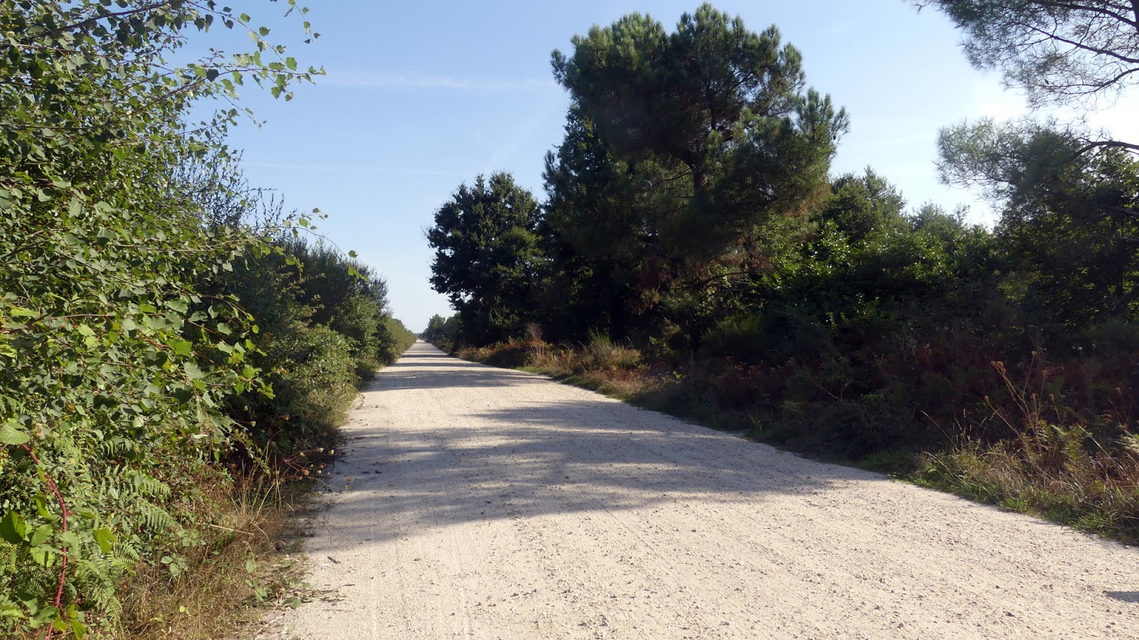 |
| This dirt track leads towards Le Murat, where the fire started. Today it is part of the GR655 "Grande Randonnée" path. |
The first people on the scene were armed with nothing more than tree branches to attempt to put out the fire, and could do nothing to prevent the flames from gaining momentum and covering further ground. The surrounding trees and bushes, which were particularly dry after a third consecutive summertime heatwave, quickly went up in smoke too.
In these post-war years, the forests in the area were poorly-maintained, dense (resin production was lucrative) and not especially accessible, and fire-fighting methods and resources were far from efficient. There were rushed attempts to set up fireproofing means to stop the wildfire spreading further, but the flames were having none of it and, fanned by strong north-eastern winds, were progressing rapidly towards Le Barp to the south-west. By now, the frontline of the fire stretched five kilometres across, and additional attempts were made to contain its progress. However, overnight, the winds changed direction, prompting the forest fire to make rapid headway, this time in a westerly direction, covering up to four kilometres per hour and soon threatening the villages of Salles and Mios.
 |
| Fighting the flames armed with buckets of water and branches. Source: INA video. |
 |
| Homes and barns going up in smoke. Source: Sud Ouest. |
Then, by mid-morning on Saturday 20th August, it was thought that the forest fire had finally been brought under control when, suddenly, the winds changed direction once more, continued to gain strength and sent the flames back in a north-easterly direction. The forest fire picked up yet again, this time more powerfully than ever, including in areas where the flames had previously died down. Over the course of an incredible 20-minute spell, the fire engulfed 6,000 hectares of land, instantly and horrifically killing 82 firefighters who had been working to contain the fire on its northern flank. The victims were mainly volunteers from the surrounding villages, some civil servants employed by the Eaux et Forêts State department, and 23 soldiers from a field regiment stationed in Châtellerault, central France. Only seven people survived what instantly became – and still remains – France’s deadliest-ever forest fire.
Throughout that afternoon, the pillar of smoke could be seen from points up to 100 kilometres away and the whole of Bordeaux and its surrounding area were plunged into other-worldly darkness by 5pm (streetlights had to be switched on unusually early that day). Around 10pm, the winds finally dropped and two danger zones remained near Léognan and the Pierroton district of Cestas, but on the whole the situation was now under control, and the final remaining flames were extinguished on Thursday 25th August, following on from a day of national mourning held on the 24th. In all, 50,000 hectares’ worth of pine forest had burnt down along with 710 hectares of bushland. According to contemporary reports (which put the overall death tally at 106), “hundreds” of farms had been destroyed and thousands of villagers had been driven from their homes (more recent accounts state that 60 homes burnt down).
The French head of government, Henri Queuille, was present at the mass funeral held a few days after the fire had subsided. Proceedings were led by the Archbishop of Paris, Monseigneur Feltin, and alongside the villagers were firemen from Kent in south-eastern England, who had been drafted in to support rescue operations in the area.
Understandably, for those who had been directly and indirectly affected by the wildfires, life would never be the same again. In comments posted beneath an authoritative online account of the events (on geographer Christophe Neff's blog "Paysages"), one person recalls being 12 years old and losing his older brother in the tragedy – the latter had been carrying out his military service with the army regiment in Châtellerault when he was assigned to these fateful firefighting duties. Another writes about his father, Jean-Max Salzmann, a military ambulance driver who the Army sent into the area alone with his vehicle to rescue people from the villages which had become encircled by flames. Initially feared dead, Salzmann eventually made it home again, but was one of just three of his 30-strong team to make it out alive. He and his counterparts had however enabled dozens of lives to be saved.
All of the villages which the 1949 forest fire almost wiped out – Cestas, Saucats, Marcheprime and Mios – have, over the years, got back on their feet and been able to flourish. The forests have grown back, no doubt taking into account recommendations about organization and a diversified choice of species made by one Pierre Allemand in related articles published by la Revue Forestière Française in 1950. (See archive copies here and here).
But some observers have been vocal in their assessment that the tragic events have almost been erased from the collective consciousness (which is possibly the reason why it has taken so long for the subject to be featured on Invisible Bordeaux…). In recent years, that particular wrong has been partially righted by the release in 2009 of a benchmark publication, Joan Deville’s “L’incendie meurtrier – dans la forêt des Landes en août 1949”, which delivers a definitive overview of the forest fire and the firefighting methods used, as well as compiling the biographical data of every one of the 82 victims.

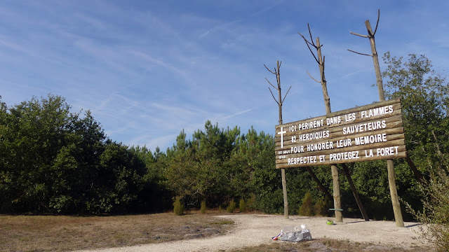
And, to bring us full circle back to the start of this article, two memorials have been erected alongside the D1010 road mid-way between Cestas and Le Barp, in an area known as Le Puch, not far from Le Murat. The more formal, ceremonial and imposing of the two (pictured above) comprises a haunting bas-relief that depicts the doomed firefighters in amongst the flames. It also lists the names of the locals who perished in what the monument refers to as a “cataclysme atmosphérique”, grouping them according to the communities they came from: Cestas, Léognan, Saucats, Villenave d’Ornon and Talence. The second is a more minimalist, organic pinewood offering, positioned around the spot where most lost their lives. It calls on observers to “respect and protect the forest to honour the memory of the 82 heroes”. Hear hear.
 |
| Engulfed by smoke and flames. Source: INA video. |
Contemporary news report. Click here if video does not display properly.
 |
| Dignitaries, mourners and Kent firemen at the funeral ceremony. Source: INA video. |
All of the villages which the 1949 forest fire almost wiped out – Cestas, Saucats, Marcheprime and Mios – have, over the years, got back on their feet and been able to flourish. The forests have grown back, no doubt taking into account recommendations about organization and a diversified choice of species made by one Pierre Allemand in related articles published by la Revue Forestière Française in 1950. (See archive copies here and here).
 |
| Back in the area, the forest fire is a distant memory. Cornfields on the left and pines on the right: diversity at work and a far cry from the dense, resin-heavy pine forests of yesteryear. |

And, to bring us full circle back to the start of this article, two memorials have been erected alongside the D1010 road mid-way between Cestas and Le Barp, in an area known as Le Puch, not far from Le Murat. The more formal, ceremonial and imposing of the two (pictured above) comprises a haunting bas-relief that depicts the doomed firefighters in amongst the flames. It also lists the names of the locals who perished in what the monument refers to as a “cataclysme atmosphérique”, grouping them according to the communities they came from: Cestas, Léognan, Saucats, Villenave d’Ornon and Talence. The second is a more minimalist, organic pinewood offering, positioned around the spot where most lost their lives. It calls on observers to “respect and protect the forest to honour the memory of the 82 heroes”. Hear hear.

 |
| Leaving the area: a lookout tower and a warning sign serve as a reminder of the constant threat that fire represents. |
> Much of the information in this piece was initially detailed and shared by the geographer Christophe Neff on his blog "Paysages", in items available here and here.
> An incredibly detailed account of the events, including further photos and a map showing the ground covered by the fire, can be found on a personal website here. The site also includes a list of the victims and pictures of further memorials in Canéjan and Cestas, here.
> Ce dossier est également disponible en français.


1 commentaires: